
 Culture and entertainment
 Supermarket
 Business and services
 Collectibles and art
 Home & garden
 Kids
 Electronics
 Computers
 Automotive
 Tools
 Fashion
 Sports & travel
 Phones & accessories
 Health & beauty
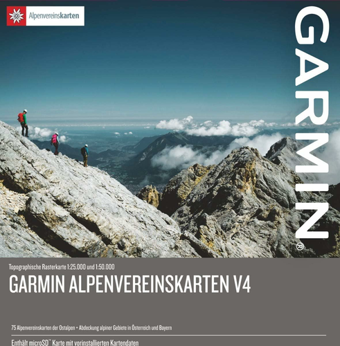

Garmin Alps Street Map v4 – Eastern Alps topographic maps, microSD/SD
Garmin Alps Street Map v4 – Eastern Alps topographic maps, microSD/SD www.KupCoChcesz.pl
Orders placed by 1:00 PM are shipped the same business day. U Ciebie pojutrze!
Availability: high stock
Dispatched within:
24 hours
Share: 


Opis
Garmin Alps Street Map v4 – topographic maps on a microSD/SD card
Alps v4 is a set of high-quality raster maps covering the Eastern Alps – mountain areas in Austria and Germany and partly in Italy. The data is supplied by the German and Austrian Alpine Club and stored on a microSD card with an SD adapter, ready to insert into a compatible Garmin device.
Scale and coverage
The maps are available at 1:25,000 and 1:50,000 scales, and the extended coverage also includes BEV raster maps at 1:50,000. In total, the card holds 75 Alpine Club raster maps, optimized for compatible Garmin devices.
Points of interest and trails
The database contains more than 80,000 points of interest (POIs), including mountain huts, towns, railway stations and peaks. The directory of mountain huts of the local Alpine Club provides photos, phone numbers and elevations, and there are also more than 2,600 ski routes in Germany and Austria.
Specifications
| Region | Eastern Alps (Austria, Germany, partly Italy) |
| Media | microSD card with SD adapter |
| Scale | 1:25,000 and 1:50,000 |
| Number of raster maps | 75 |
| Points of interest | over 80,000 |
Product reviews
Ask a question
We will send the answer to your e-mail address.
Similar products









Own this product?
Rate Garmin Alps Street Map v4 – Eastern Alps topographic maps, microSD/SD and help others choose.
Add a reviewCustomer reviews (0)
This product has no reviews yet — yours could be the first.
Add a review
Sign your name and write a few sentences about the product.